Showcasing Important Migration Routes
The Nature Conservancy New Jersey
GreenInfo team: Maegan Leslie Torres
Project years: 2022
Tags: Cartography Communications Conservation GIS Services Graphic Design
Overview
What challenges is this project trying to solve?
- The most effective way to showcase bobcat migration routes is through a map.
What were the client’s objectives?
- Create a visual map that showcases bobcat migration routes as well as a reference map of Bobcat Alley.
Results
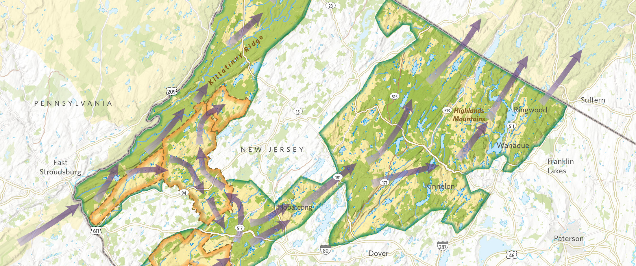
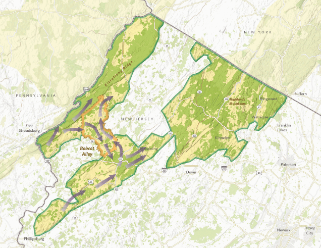
- A map of TNC's Resilient and Connected Network which focuses on resilient sites, confirmed biodiversity, and climate flow.
- The creation of a gif showcasing the generalized migration data of bobcats in New Jersey.
The Work
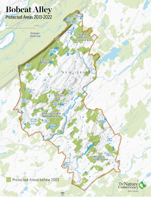
Within New Jersey is Bobcat Alley, a 96,000 acre wildlife corridor managed by The Nature Conservancy New Jersey to assist in the recovery of the bobcat population. GreenInfo Network helped to create a reference map of Bobcat Alley to tell the story of The Nature Conservancy’s efforts to foster the habitat greenway.
We also created ESRI ArcPro map layouts for TNC New Jersey that focused on partnerships, species, as well as showcasing TNC’s Resilient and Connected Network. TNC’s Resilient and Connected Network focuses on 1) resilient sites: sites with connected microclimates representing all physical environments therefore supporting a diversity of plants and animals as they respond climate change, 2) confirmed biodiversity: sites recognized for their current biodiversity values, and 3) climate flow: corridors or flow zones that facilitate plant and animal movement for climate adaptation.
Additionally, GIN created an animated gif showing a generalized migration data highlighting the migration routes to help TNC New Jersey highlight the important migration routes in presentations and other virtual spaces.