We create, analyze, visualize, and communicate information in the public interest.
GreenInfo Network creates data, maps, and websites to support public interest groups and agencies across the country. Since 1996, GreenInfo has been a national leader in the geospatial field.
Climate resilience. Land conservation. Equitable access to nature. Voting rights. Public health. Clean water. Affordable housing.
These are just some of the issues our team and clients work on.
Our clients’ needs and goals are the driving force of our projects. We deliver user research, thoughtful design, and innovative technology. Our data, tools, and maps are meaningful, accessible, usable, and impactful.

What we do
At GreenInfo Network, we:
- Make spatial information compelling and clear.
- Create maps, data, and websites for public interest organizations and agencies.
- Help our clients articulate what they need, so our solutions meet their goals.
Creating Spatial Web Applications
- Design Research
- Interface Design
- Application Development
Developing and Stewarding Public Data
- Protected Areas Databases
- School Campus Databases
Featured projects
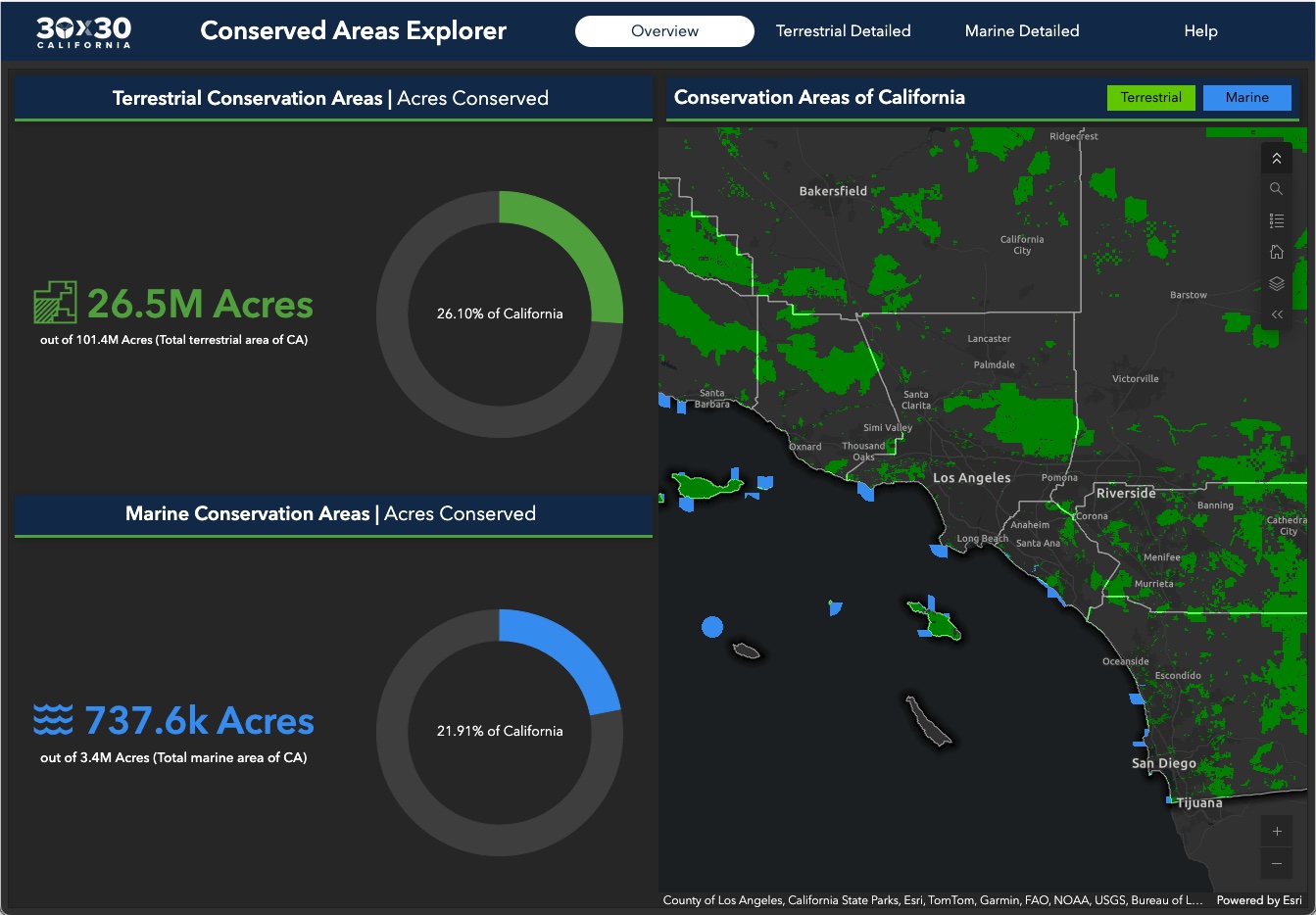
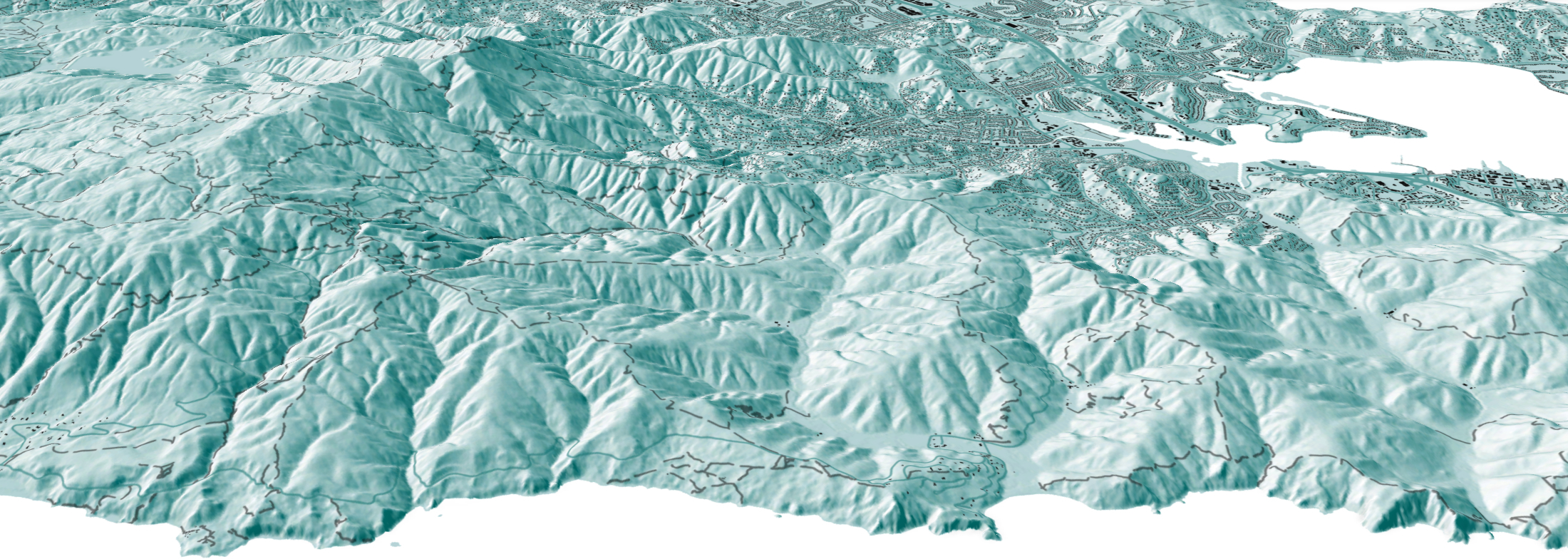
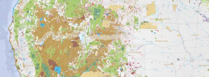
Conserving 30% of California by 2030
GreenInfo Network is the data partner for California's efforts to conserve 30% of its lands by 2030. We work closely with the state Natural Resources Agency to gather, process, and publish the data California uses to track progress toward this major milestone.

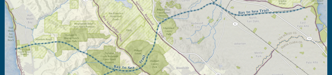
Guiding $1.5 billion for equitable park access
California voters have often supported bond measures to help build local parks. The Department of Parks and Recreation is charged with distributing those funds. We created parksforcalifornia.org to showcase that work. It also hosts tools that make it easier for local park advocates to apply for funding, and for the state to ensure those funds are equitably distributed.
Read more about Guiding $1.5 billion for equitable park access

Mapping California’s Public Lands
Before GreenInfo created the California Protected Areas Database, there was no single source of data about protected lands in California. Now, the database has become a national model and a foundation for a huge range of conservation and park equity work.
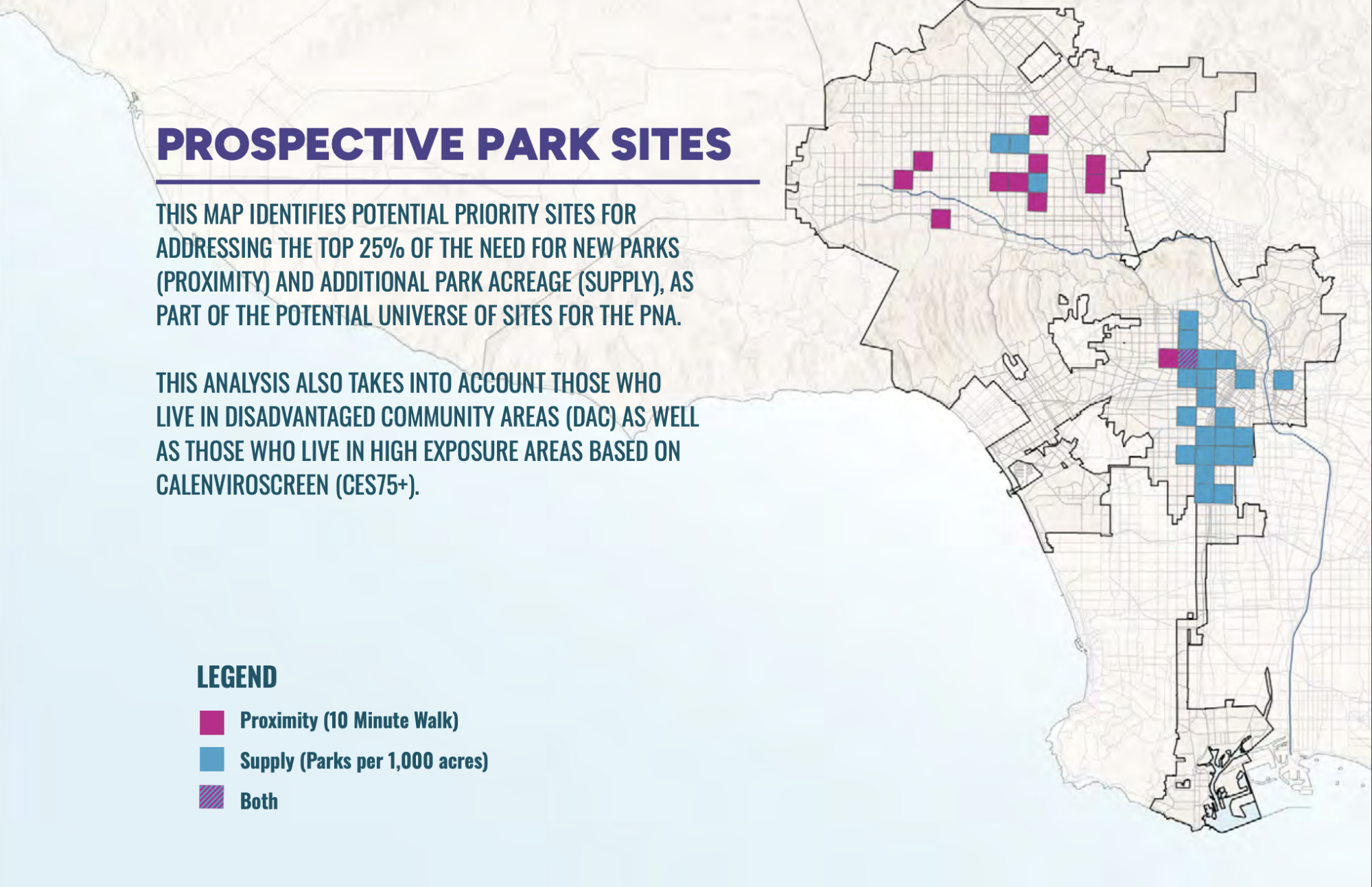
PerSquareMile data supports first park needs assessment in Los Angeles since 2009
In early 2025, the City of Los Angeles undertook its first Park Needs Assessment since 2009. GreenInfo joined the team to help determine where new parks would have the most impact. We developed the PerSquareMile tool with UCLA to select 36 locations where new parks would most benefit people who lack park access.
Read more about PerSquareMile data supports first park needs assessment in Los Angeles since 2009
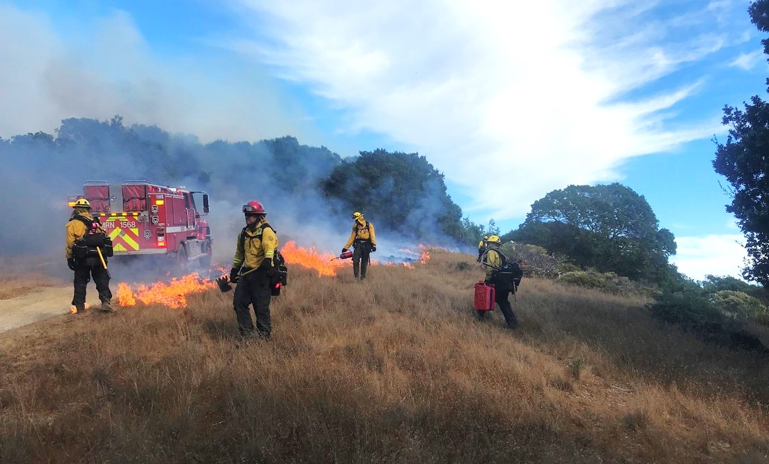
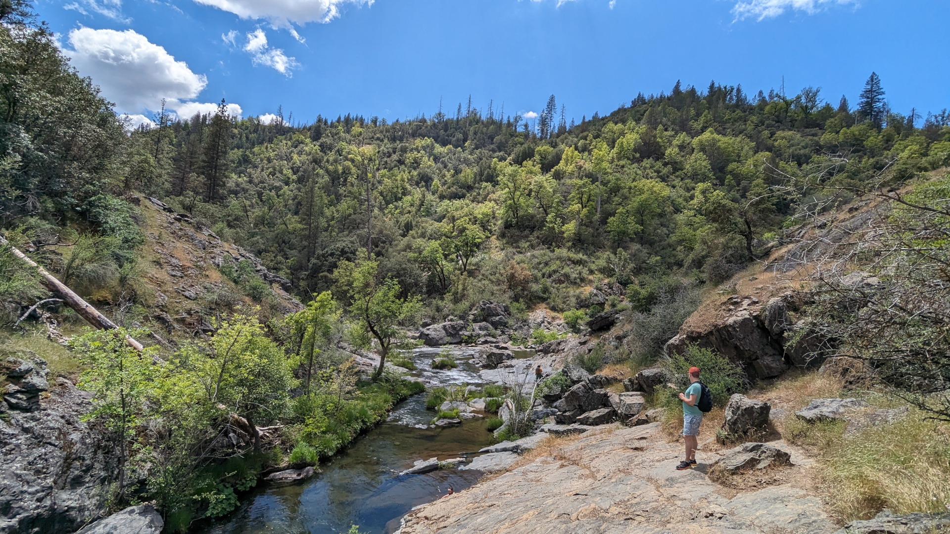
Reducing Wildfire in Marin County
Wildfire is a fact of life in California. In 2000, Marin County residents voted to fund a new agency, the Marin Wildfire Prevention Authority, to chart a path to a fire-resilient future. We helped them build a mapping and data program to track their progress.
How we do it
Beautiful Maps
- Our maps communicate effectively.
- Tell stories that inform, motivate, and educate viewers.
Design research
- Put people first.
- Talk to the people who use what we’re making, so they’re part of the process.
- Understand people’s needs and design things that work for them.
Accessibility
- Make maps and data presentations that embrace accessible design.
- Use industry standards to measure our work.
Spatial analysis
- Draw on a full array of Esri ArcGIS and open-source tools for analysis.
- Build on decades of experience working with a wide range of data.
- Give our clients the best mix of speed, accuracy, and repeatability.
Web development
- Build applications using open-source software, Esri ArcGIS Online, and other industry-standard tools.
Find the right balance of cutting-edge approaches and stable, well-known approaches.
Ethics and equity
- Acknowledge that data, information, and the maps we make from them are powerful and can be tools for equity.
- Evaluate how we support and lift up institutions that represent marginalized communities.
- Produce work that helps our clients center equity and justice.


Who we help
Our clients’ missions focus on environment, public health, education, and social justice.
We help our clients use maps and data to achieve mission-critical goals. Goals such as distributing public funds to people who most need parks or assessing the fairness of election laws. Since 1996, GreenInfo has collaborated with more than 1,000 organizations and agencies. We deliver insightful user research, thoughtful data analysis, and innovative design.
We commit to partnering with clients who contribute to a just and equitable world.
Some of our partners

What our clients are saying
We’ve got a lot of compliments on the additions and updates to the building reports. Thanks again for pulling off this project on a short notice and with a quick turnaround!
— Terry Sullivan, City of Seattle
We used the tool and data GreenInfo Network designed to get coverage on the front page of the San Francisco Chronicle and to advance our case in Sacramento.
— Annie Burke, TOGETHER Bay Area
Many thanks for your incredible work, I’m thrilled to hear about the data release!
— Lisa Henriksen, PhD, Senior Research Scientist, regarding the California School Campus Database
Join our mailing list
Get our quarterly newsletter with case studies, blog posts, and insider info from the GIS and web mapping industry. We also include periodic invitations to GreenInfo Network webinars and other events.