What we do
Mapping and data services
GreenInfo is a recognized leader in creating data-driven maps that communicate effectively.
In our work, we:
- Tell stories that inform, motivate, and educate.
- Design beyond the map, ensuring our work fits within our clients’ overall communication strategy and branding.
- Draw on work with hundreds of nonprofits and public agencies, including helping clients develop their own GIS programs through learning and training.
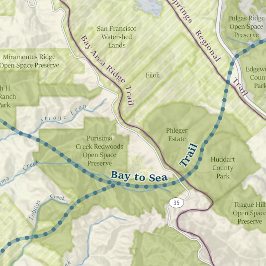
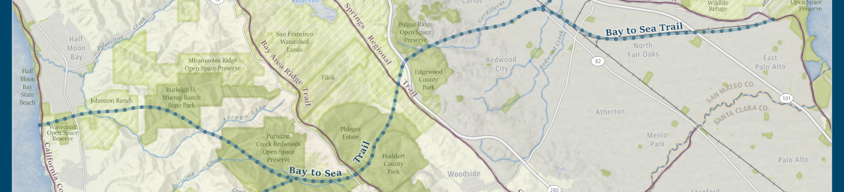
Cartography
GreenInfo is widely known for the quality of our cartography. A few of our calling cards:
- Spatial information is effective only when it is compelling and easy to understand.
- Focus on the purpose of each map.
- Ensure the map contains clear branding and organizational presence.
Data analysis
- To deliver powerful analysis, use data from leading, authoritative sources.
- Working closely with our clients, develop data through data scraping, digitizing, and geocoding.
- Use diverse analytical tools to turn this data into actionable insights.
- Create clear and thorough documentation so the work is reproducible and defensible.
Automation
- Develop scripts and processes to maximize efficiency while detecting and reporting errors.
- Work at larger scales drawing on more data.
- Confidently make updates more quickly.

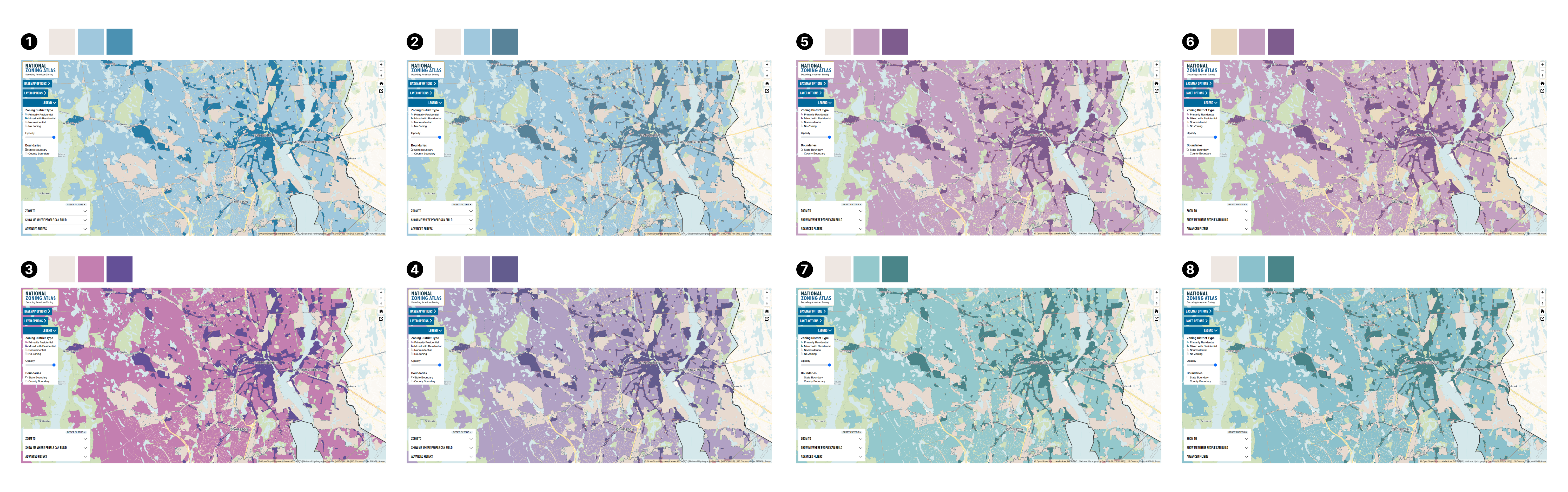
Creating spatial web applications
Our approach to web mapping applications focuses on customized, affordable solutions.
- Design visually attractive and effective interfaces.
- Make toolboxes that clients use to collect and edit their own spatial data.
- Build on-the-fly mapping and charting applications, and full-featured thematic maps.
- Built mostly with open-source software: MapLibre, Leaflet, and Django, to name a few.
Design research
Design research helps us build the right tools by putting people first. Our research methods include:
- Listening sessions, interviews, and surveys to gather participant knowledge early in the project.
- Comparative analyses of existing platforms to build on what has come before.
- Testing finished designs and working applications
We invest time in talking with people about their day-to-day lives, challenges, and aspirations. This helps us build interactive experiences and data platforms rooted in people’s needs.
Interface design and development
- Translate objectives and messages into clear and engaging websites.
- Deliver beautiful, reliable, and easy-to-use websites and applications.
- Balance the latest technology with long-term sustainability, so our clients’ investments will last.

Developing and stewarding public data
Most public agencies and nonprofits that own land do a very good job of managing data about their own properties. Park agencies know where their parks are, and school districts know where their schools are. But hundreds of entities own and operate parks and schools. To know which schools and parks serve a community, it’s not enough to have data from a single agency. Our public data projects provide a comprehensive, reliable source of data for every agency.
Protected areas databases
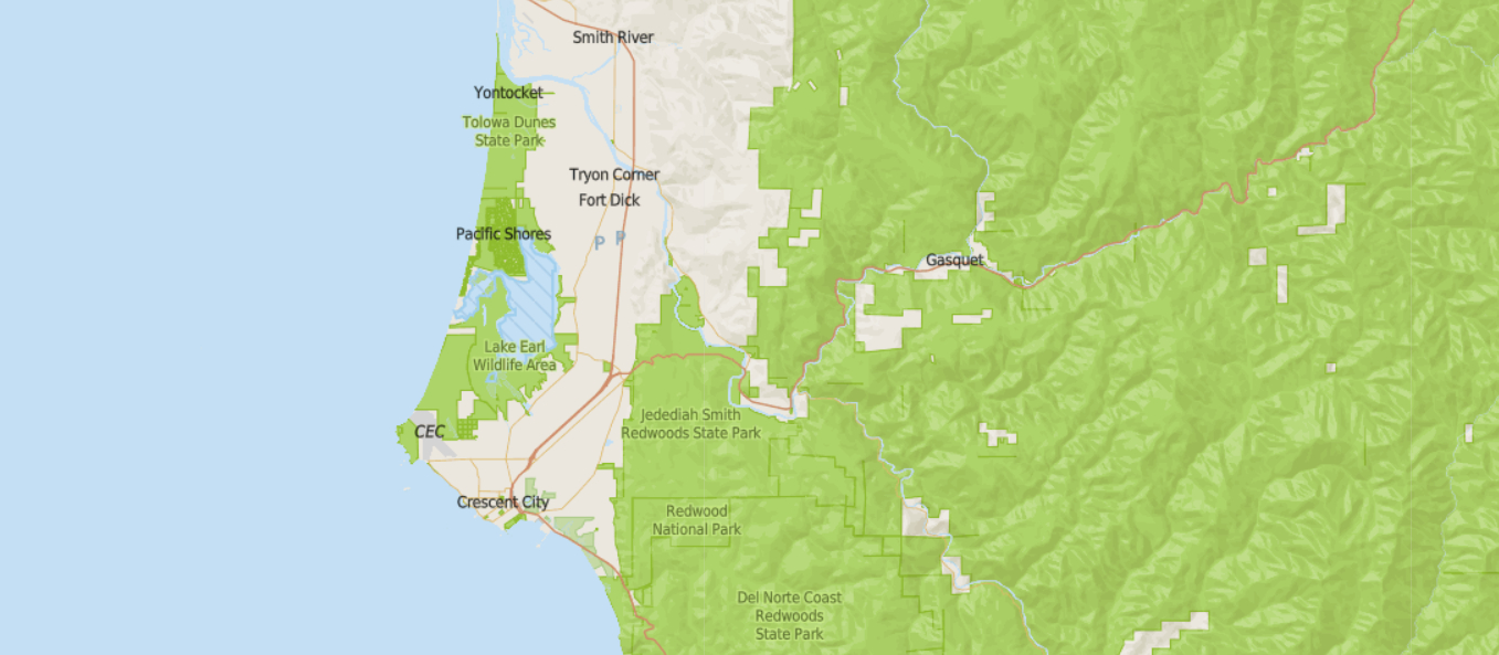
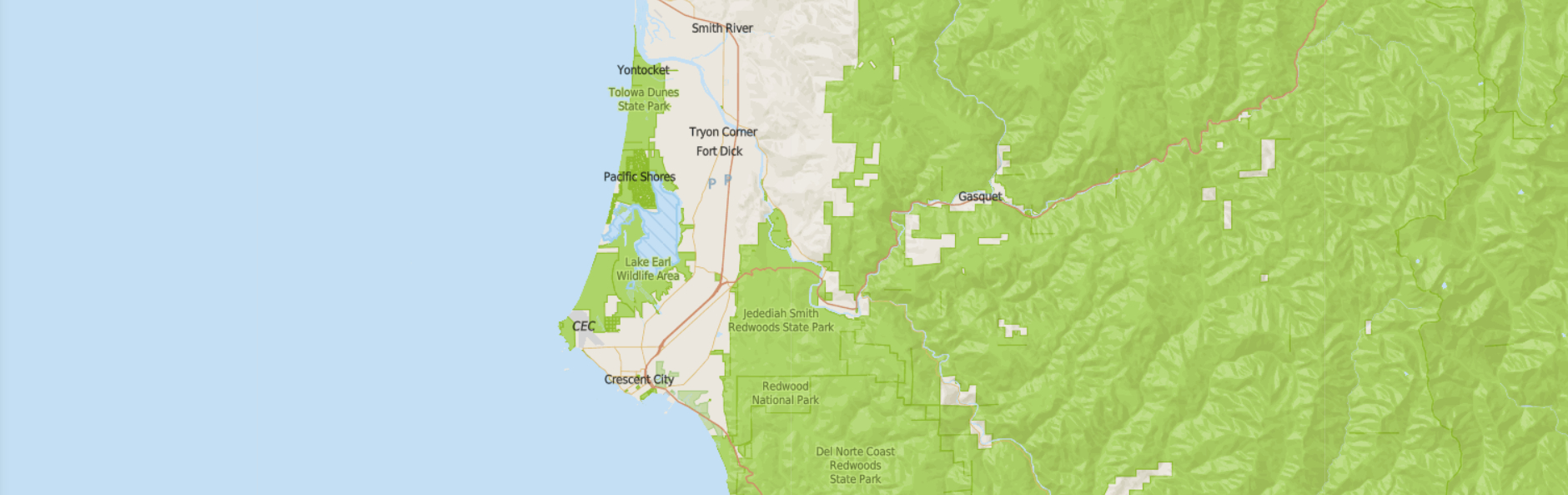
In 1996, we began developing what would become the California Protected Areas Database (CPAD). We wanted to quantify the collective impact of conservation efforts across whole regions and states. Our data is now the most detailed and extensive such dataset in the country.
The California Protected Areas Database is a GIS dataset depicting lands that are owned and protected for open space purposes by over 1,000 public agencies or non-profit organizations. The database depicts the wide diversity of parks and open spaces in California, ranging from our largest national forests and parks to neighborhood pocket parks. The companion California Conservation Easements Database includes lands covered by conservation easements.
Both datasets are essential to California’s 30×30 initiative to conserve 30% of the state’s land and waters by 2030. The databases created a national model for collective data. This led to the development of the Protected Areas Database of the United States (PAD-US). We continue to operate as a core cooperative partner with the US Geological Survey to manage PAD-US.
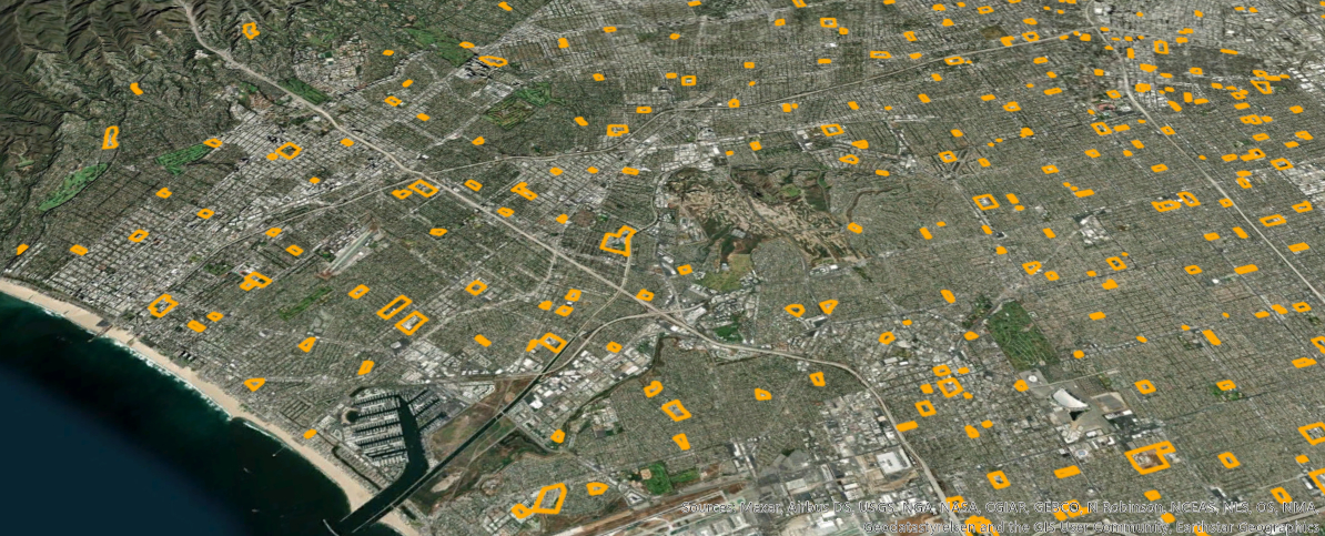
School campus database
Working with Stanford Prevention Research Center, we developed the California School Campus Database. It is the first statewide database of campus boundaries. It provides accurate campus locations and extents, and it tracks multi-location campuses.
We have also mapped schools in major cities across the country. Our goal is to do this for more states across the nation, so more states have access to comprehensive and accurate GIS data for all public schools.