Who we help
Our clients’ missions focus on environment, public health, education, and social justice
We help our clients use maps and data to achieve mission-critical goals. Goals such as making conservation plans or distributing public funds to people who most need parks. Since 1996, we have collaborated with more than 1,000 organizations and agencies. We deliver user research, data analysis, and thoughtful design.
Environment
Summary
We help conservation organizations, land trusts, funders, and advocates address critical issues:
- Climate change
- Access to nature
- Biodiversity
- Land protection
Featured work
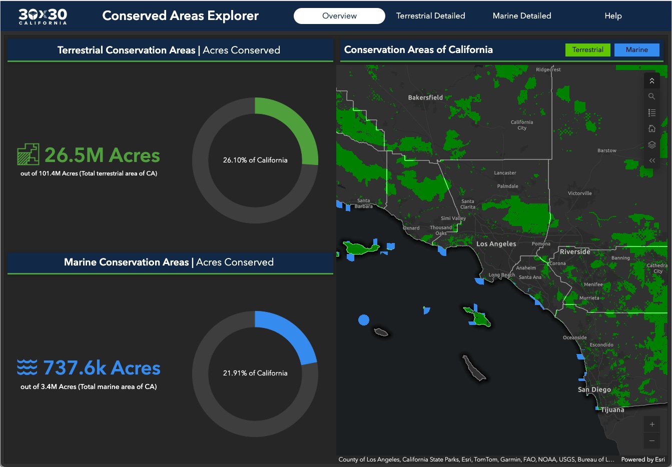
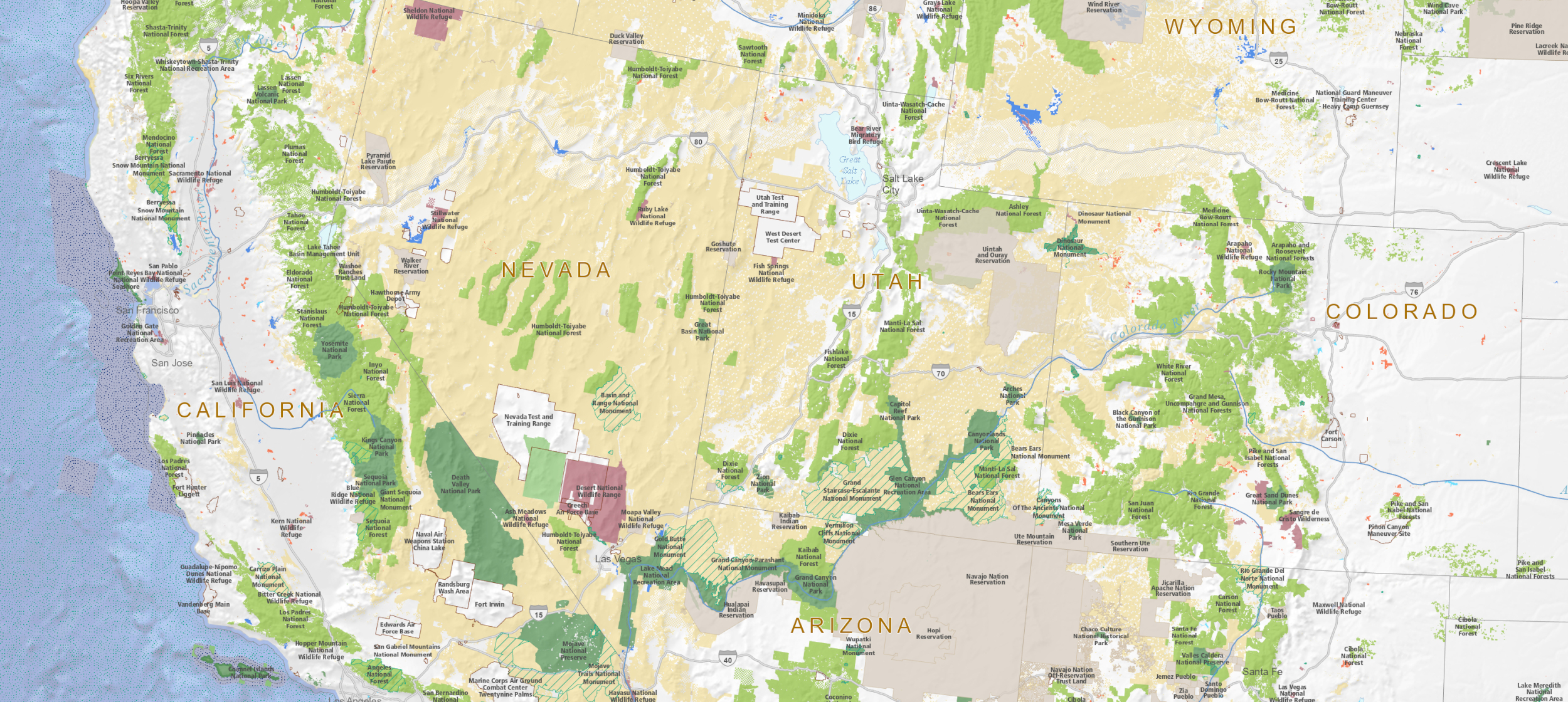
Conserving 30% of California by 2030
GreenInfo Network is the data partner for California's efforts to conserve 30% of its lands by 2030. We work closely with the state Natural Resources Agency to gather, process, and publish the data California uses to track progress toward this major milestone.
Public Health
Summary
We use mapping to support public health organizations:
- Assessing the locations of key community assets
- Analyzing spatial patterns of health factors
- Visualizing community demographics
Featured work
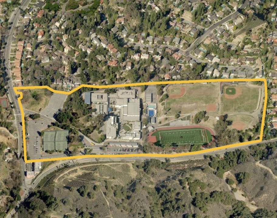
Putting 10,000 School Campuses on the Map
Schools should be safe spaces where kids can learn and thrive. Public health researchers have long studied the negative impacts of commercial tobacco sales and marketing near schools. But they were working from imprecise and often inaccurate maps until we created the California School Campus Database.
Social Justice
Summary
We help organizations map disparities:
- Assessments of park access or affordable housing to guide community investment
- Mapping transportation networks and access
- Analyzing demographic and income patterns
Featured work
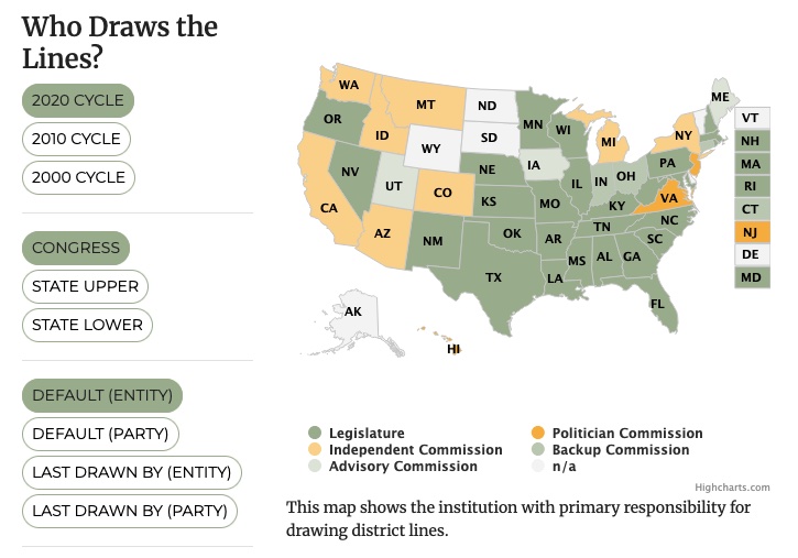
Remaking a Major Guide to Redistricting
Every 10 years, the geographic boundaries that define our democracy are redrawn. It’s an obscure but very important process. And it can be done fairly — or not. Legal Scholar Justin Levitt is a nationally known expert on redistricting, and we helped create the online home of his All About Redistricting project.