Mapping to Make Monuments
Coalition of local organizations
GreenInfo team: Stephanie Ding
Project years: 2024
Overview
What challenges is this project trying to solve?
- During the Biden Administration, advocates in California had a unique opportunity to propose large new national monuments to preserve critical landscapes for people and nature.
- A successful monument campaign needs support from a wide range of stakeholders, including Native tribes, recreational users, wildlife advocates, and other local communities.
- Creating a new national monument requires a lot of mapping support, to both define the proposed boundary and communicate the importance of the lands inside that boundary.
What were the client’s objectives?
- The maps and data should reflect the concerns of many stakeholders, including Native tribes seeking to protect their homelands.
- The maps need to make the case for a new monument, while also being careful about sensitive information provided by Native tribes.
Results
- Two new monuments were approved: The Satilla Highlands and Chuckwalla National Monuments. Together they cover almost 1 million acres.
The Work
Our work with Tribes and conservation advocates in California was an essential part of campaigns that led to the designation of two new national monuments: Sattitla Highlands and Chuckwalla. We also supported a co-stewardship agreement between the Fort Yuma Quechan Tribe and the Bureau of Land Management for the proposed Kw’tsan National Monument.
GreenInfo worked with Tribal leaders, local community organizations, and other consultants to help determine the boundaries of the National Monuments. We also provided maps for the reports for each national monument that went to the Biden Administration.
The Sattitla Highlands monument encompasses almost 225,000 acres on the Modoc, Shasta-Trinity, and Klamath national forests and provides protection to tribal ancestral homelands, historic and scientific treasures, rare flora and fauna, and the headwaters of vital sources of water. The Sáttítla Highlands include the ancestral homelands of and are sacred to the Pit River Tribe and Modoc Peoples. The Karuk, Klamath, Shasta, Siletz, Wintu, and Yana Peoples also hold deep connections to this area.
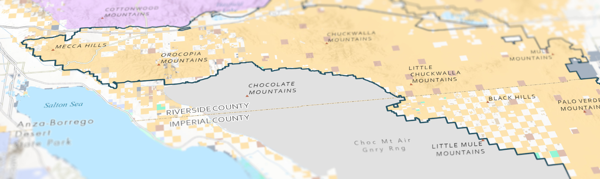
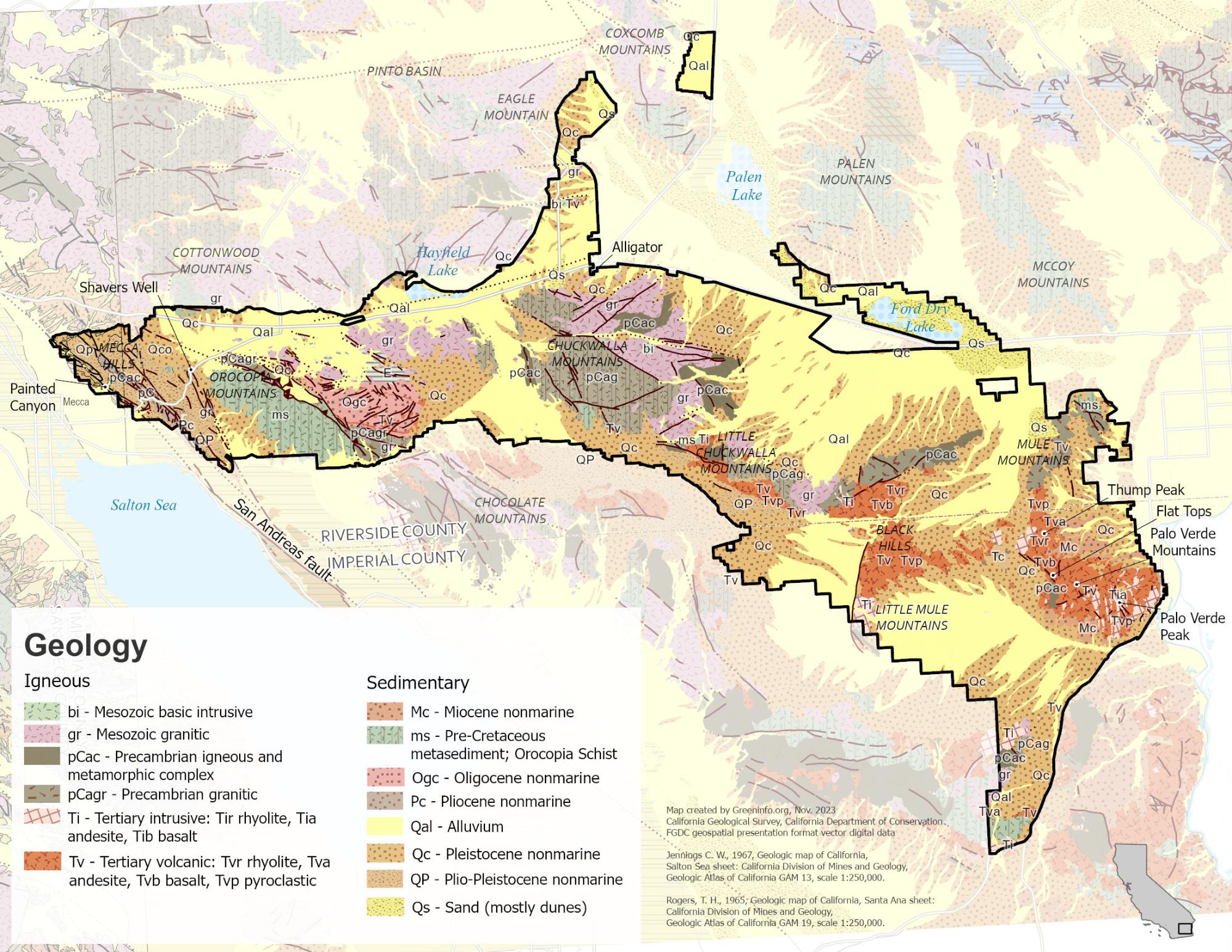
The Chuckwalla National Monument spans nearly 740,000 acres, of which about approximately 624,000 acres are public lands managed by the Bureau of Land Management in Riverside and Imperial counties. The Sonoran and Mojave Deserts come together here, and these lands are home to the Iviatim (Cahuilla), Nüwü (Chemehuevi), Pipa Aha Macav (Mojave), Kwatsáan (Quechan), and Maara’yam and Marringayam (Serrano), and other Indigenous peoples.