Reducing Wildfire in Marin County
Marin Wildfire Prevention Authority
GreenInfo team: Maegan Leslie Torres
Project years: 2023-2025
Overview
What challenges is this project trying to solve?
- As a brand new agency, the Marin Wildfire Prevention Authority needed a complete mapping program.
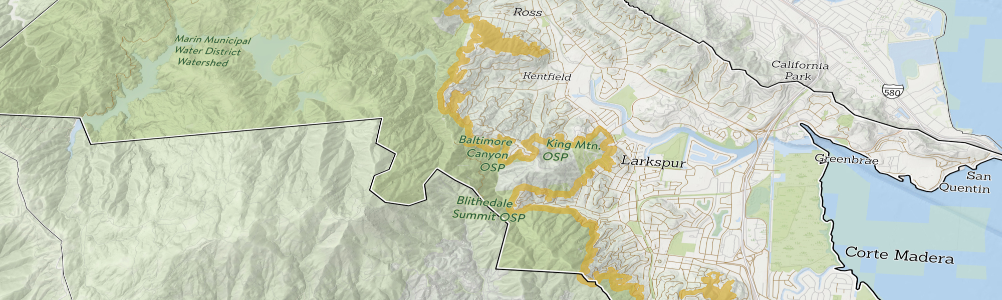
- Marin Wildfire urgently needed to portray wildfire risk reduction activities across Marin County. The agency values both public transparency and accountability for how it is spending tax dollars.
- Dashboards needed to draw on data from a range of other organizations.
What were the client’s objectives?
- Establishing basic standards for GIS data storage and sharing
- Showing the public how the Authority is doing on reaching its five main goals.
- Helping 17 member agencies produce consistent data.
Results
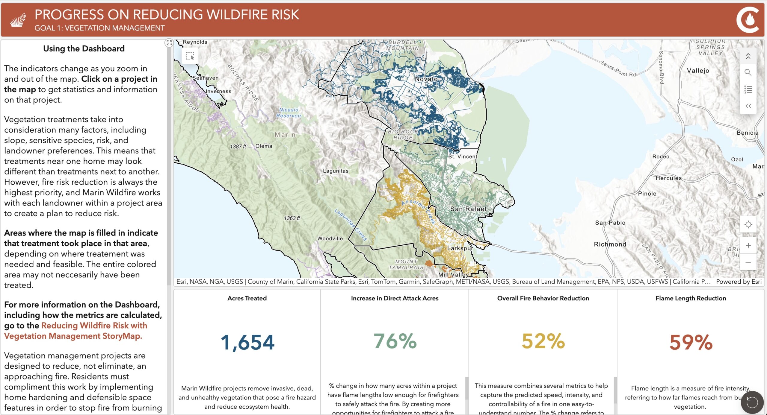
- Up-to-date dashboards measure progress on vegetation management and inspection of defensible space around homes.
- Data standards and methods allow member agencies to share data about vegetation management work.
- Consistent, countywide data about vegetation management contributes to updated risk assessments that determine if projects are delivering on reduced risk of wildfire.
The Work
We work in partnership with the Marin Wildfire Prevention Authority and other technical partners.
We helped Marin Wildfire develop their mapping program. And we developed publication maps and online dashboards of key metrics.
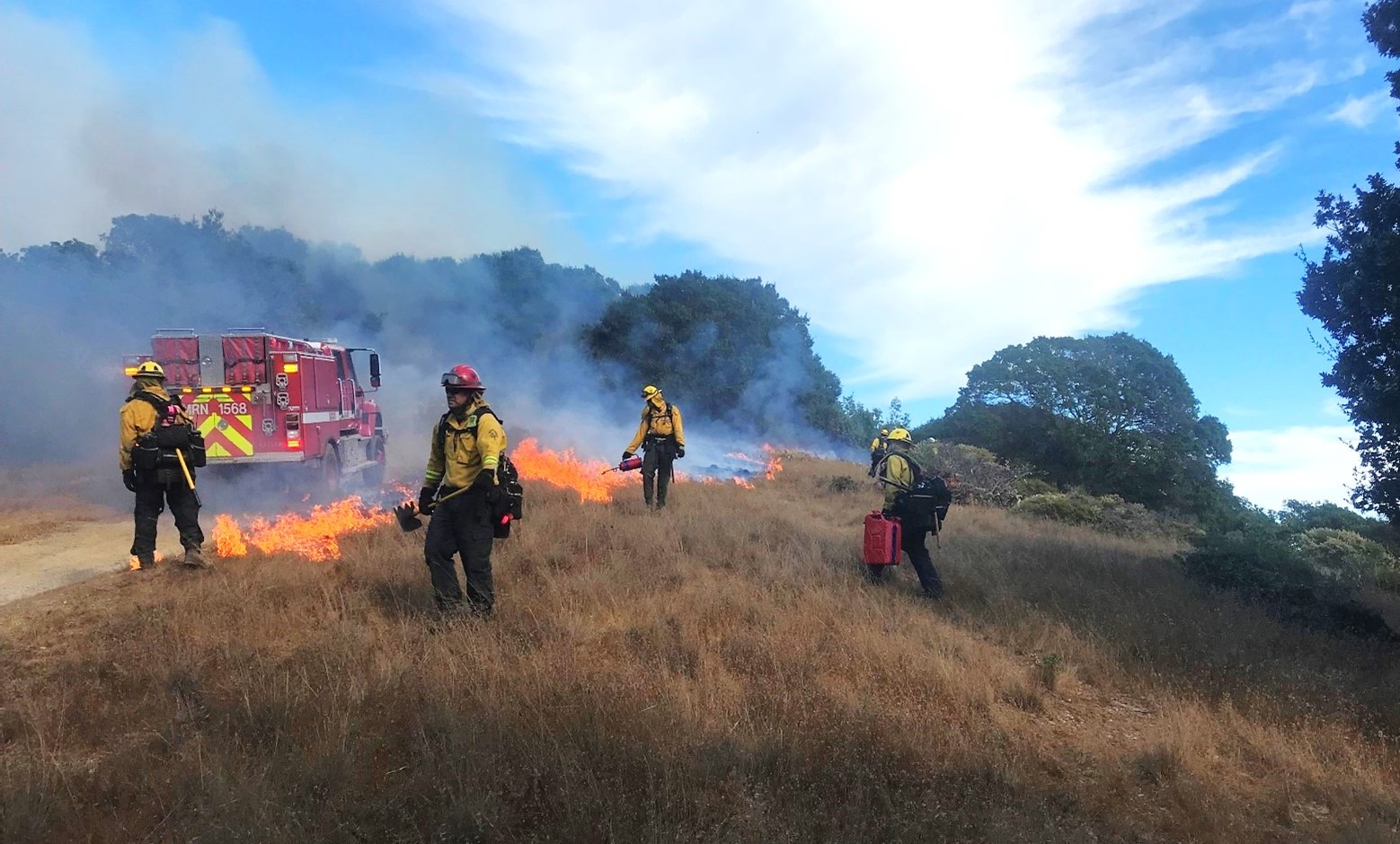
To track two important metrics, we developed dynamic dashboards. The first tracks vegetation management work, important for reducing the fuel feeds fires. We helped some of Marin Wildfire’s 17 member agencies improve their data collection. The data from all agencies now meets the same standards.
The second dashboard tracks defensible space and home hardening, back to 2023. This data feeds into updated risk assessments to determine if projects are reducing wildfire risk.
We have also developed publication maps, built internal tools, and provided member agencies with on-call mapping support.